Less than 100 km's from Tokyo is the mountainous Fuji-Hakone-Izu National Park. This park has some of the best Hakone trails for hiking and running. You have to be lucky to see Mt Fuji, but it is worth the chance. If you cant' see Fuji, the trail system around Hakone will not disappoint. The trails run up and over tree covered peaks, and back down into lush valley's with amazing waterfalls. One of the best day hike's is between the 350 year old Ancient Cedars near Lake Ashi.

Route
You will need an offline map with GPS to find your way around the Hakone trails. First, pick up a free local trail map at a hotel to plan your route. There a lots of trails in Hakone that have been abandoned, which is why I you need to local trail map. The Alltrails App is great once you know which trails are still in use. There are very few signs on the this trail. Lots to see on this tough trail run.
Navigation
You really need to work hard to stay on the trail. Study the map so you know when to expect a junction, and best to keep tabs on the offline map. Had a tough time finding the trails when they crossed over the road. It doesn't really matter which way you go, as long as you head in the right direction, since the trail follows the road. Ancient Cedar Avenue is not included in the All Trails route, but it is only a few hundred meters away from the end.


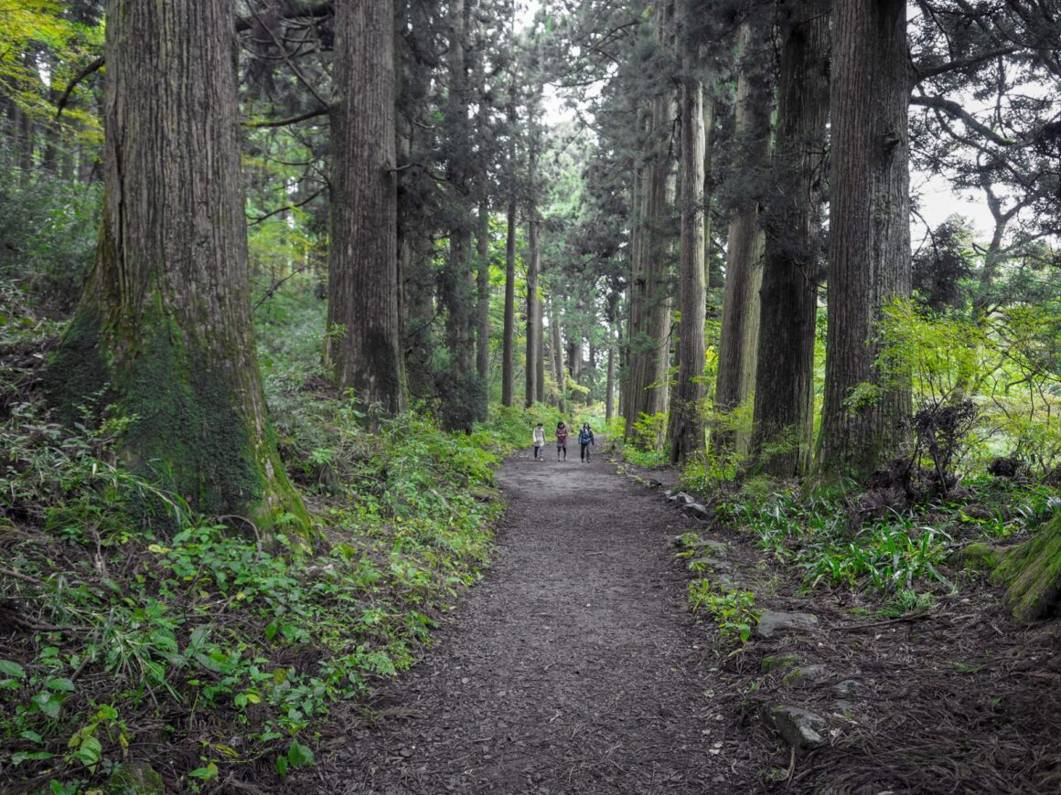
Old Cedars, Waterfalls, and Vertical
Ancient Cedar Avenue is lined with 350 year old cedars and is one of the best Hakone Trails. Hard to believe it used to be a road, but everything here is super old. Chisuju Falls is so amazing, it almost looks man made. Hakone is steep, and this trail feels like you are always going up.
Nearby Trails
The mountains in Kyoto offer another great adventure. For instance, one of the best hikes in all of Japan is under the thousands of orange gates on the Fushimi Inari Shrine trail.


Trip Advice
3 Hour Trail Run
Offline Map Mandatory
Very Few Hikers
Chisuji Falls
Ancient Cedar Avenue
Lots of Vertical